The combination of Google Sketchup and a GIS is an obvious one. The easy-to-use 3D modelling software from Google is ideal for architectural concepts and visualisations. These concepts are easy to place in a 3D GIS environment like Google Earth or Esri’s ArcScene. There are numerous examples where this interaction is applied.
But there are few examples that work the other way around. A GIS system can be of great use to visualize your architectural model in a “real” environment. This is especially true for landscape architects that work with large models.
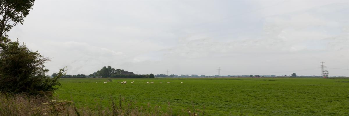
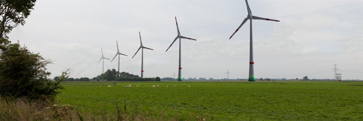
When public support is needed for landscape plans, it can be helpful to visualize these plans in the existing situation. This can be done by projecting a 3D model over a photograph of the current situation.
The location of the photograph can be put in GIS in combination with some characteristic landscape objects like pylons, building or telephone poles. These can then be exported to Sketchup to give an indication of where the landscape model should be situated.
By setting your viewpoint at the location of the photograph and using the photograph as a watermark, the landscape object can be aligned with the watermark. In this way the planned landscape model will be shown in the right proportions and perspective.
This scene can be post processed with digital photo editing software to create a realistic visualisation of your proposed land use plans.